We left Bristol in cloudy skies, but as we arrived in Wales the cloud lifted and we were treated to bright sunshine and blue skies. We parked in the car park marked with a P on the map which was sadly filled with rubbish from previous visitors.


We were aiming straight onto the top of the escarpment so took the track leaving the car park. Once onto the top we headed over rough ground to reach our first hill top (Twr Pen-Cyrn) listening to our first Skylarks of the year as we went. The top has ancient hollowed out cairns on it, and we enjoyed some lounging in the sunshine. Last time we were up on these tops the ground was boggy, and we also came upon an adder on the path. On this occasion the ground was incredibly dry and we spent a large proportion of the walk paranoid we might disturb a basking adder (thankfully we didn't though)


From Twr Pen-Cyrn we made a beeline for Mynydd Llangatwg where the cairns could already be seen over the horizon. We missed the path (if there was one) and ended up going over more rough ground. The skies were incredibly hazy although we still had a nice panorama of the surrounding hills - it was would a brilliant spot to be on a really clear day. The tops of Pen Y Fan and Corn Du could be seen to be nearly snow free, making it feel even more like spring.


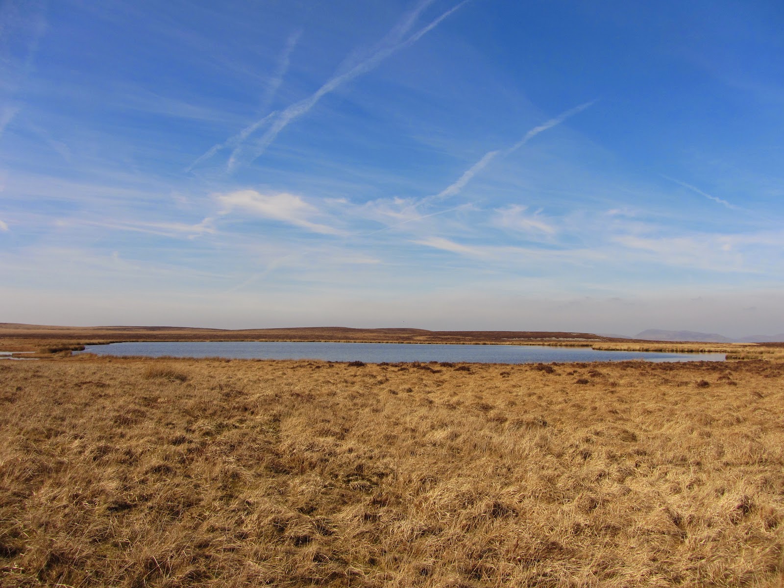
We'd brought our swimming stuff as it was so mild outside, so headed next for the lake Pwll Gwy-rhoc. On the last occasion we had visited the lake it was so boggy we had to resort to removing our boots to get to the shore. Thankfully although boggy we could make it to the edge without removing anything. I got into my swimming kit first, my feet were imediately in pain with the cold - I think they had got so warm in the boots it was making the cold feel even worse. After much procrastination I finally got in, but didn't stay in for long as it was freezing! Had I brought my neoprene socks I probably would have managed a bit longer..


Once Steve had his turn at swimming we enjoyed some hot coffee to warm up, took a compass bearing and made our way to our next way point- a swallow hole marked as a pool of water on the map. This was another stunning spot and would also make a great place for a swim or a wild camp - the water was so deep the bottom couldn't be seen.


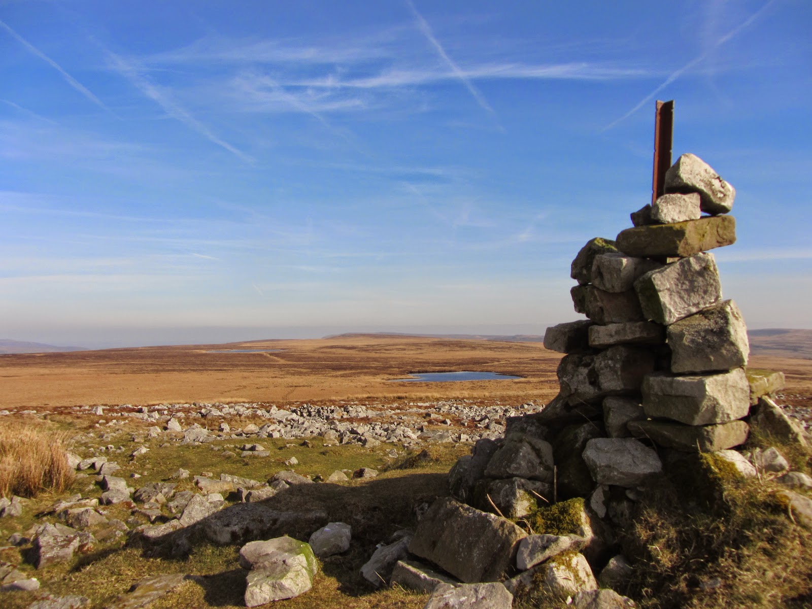
We headed towards a cairn on the horizon which based on our compass bearing was close to the road. It caused us a littler confusion as it looked prominent enough to be marked on the map, but wasn't. When we arrived at the cairn and could see the road we knew that it was an area marked as stony on the map as there was nothing else similar around.

Unsure what these old building are?


Rather bizarely there was a nice wide track heading back in the direction of the road (which wasn't on the map!) and it was a relief to follow it back to to the road looking at many sink holes on the way. The ground beneath the area has over 40 miles of cave passage, so it's no suprise there are sink holes left right and centre! As cavers we were tempted to keep checking out the holes for cave entrance, but only found one though.


We crossed the road and traversed along the side of the hill to reach Craig Y Cilau nature reserve. As we'd left the car at 1pm it was getting quite late at this point and we knew we needed to make quick progress back to the car (we had a deadline to be home by 7 for when my Daughter was being dropped on)

As we got into the main part of the nature reserve we realised that we wouldn't be able to follow it along as a high level as we planned as there was no path beneath the cliffs, and falling rock signs. The only option was to drop down, and head back up to the other side to pick up a footpath leading up to the main tram road. A frustrating navigation error at such a late point in the day! We'd walked to the cave Agen Allwed before and had incorrectly assumed the tram road carried all the way round the cliffs.

The walk through the trees back to the tram road was very rocky and hard on the feet at a fast speed, but would be a lovely path to follow at a less speedy pace. The tram road was familiar from various caving trips and Steve marvelled at the volume of entrances into Eglwys Faen (cave) as we passed. We picked up another footpath beyond this point which took us on a high level park pack to the carpark. Sadly we were only just back to the car in time so I didn't have time to litter pick the carpark, I will remember to bring a bag and picker next time I visit the area though.


The moor about Llangattock is beautiful on a clear calm day, it's not a place I'd like to be in bad weather though, especially with the lack of clear paths, and obvious features. It was a relief to be somewhere so quiet after our very busy trip to the lakes last month. The nature reserve is full of interesting wildlife, plants, flowers, birds and it well worth an explore on it's own. You can pick up leaflets describing what can be seen from both entrances. A word of warning, take care for falling rocks when sheep are about - there is a significant amount of scree around which they can knock off, we also came upon a huge boulder which looked like it had recently fallen onto the tramway.

